

You can find on this page the Israel cities map to print and to download in PDF. The Israel map city presents main cities, towns and presents the capital of Israel in Asia.

The map of Israel with cities shows all big and medium towns of Israel. This map of cities of Israel will allow you to easily find the city where you want to travel in Israel in Asia. The Israel cities map is downloadable in PDF, printable and free.
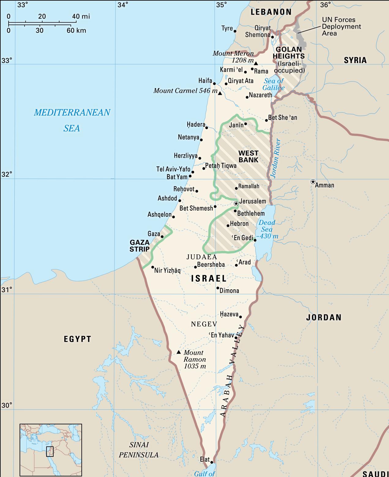
Nazareth, the largest city in Galilee as its mentioned in the map of Israel with cities, is known as the Arab capital of the country because its residents are predominantly Arab citizens of Israel. Haifa often gets omitted from itineraries, and it's too bad, because this city is so beautiful. For the best view of the port, go to the Central Carmel at the top of the mountain and walk along Panorama Street (Yefe Nof). Plenty of gardens, zoos, and shopping areas offer picturesque areas for strolling and relaxing.
Acre as its shown in the map of Israel with cities is a city in the northern coastal plain region of northern Israel at the northern extremity of Haifa Bay. The city occupies an important location, as it sits on the coast of the Mediterranean, linking the waterways and commercial activity with the Levant. Herzliya - is a city in the central coast of Israel, at the Northern part of the Tel Aviv District. Beersheva - is the largest city in the Negev desert of southern Israel. Often referred to as the "Capital of the Negev". Eilat is Israel southernmost city, a busy port and popular resort located at the northern tip of the Red Sea, on the Gulf of Aqaba.
Caesarea city is both ancient and new. It was founded by Herod the Great in honor of Caesar Augustus, who gave him the city. Ramon Crater is the largest of three erosion craters found in the Negev Desert as you can see in the map of Israel with cities. The geological landform is believed to have started forming millions of years ago when the ocean began receding. Situated on a high plateau in southern Israel overlooking the Dead Sea, Masada was the last Jewish holdout to fall to Rome at the end of the First Jewish–Roman War.
The map of Israel with major cities shows all biggest and main towns of Israel. This map of major cities of Israel will allow you to easily find the big city where you want to travel in Israel in Asia. The Israel major cities map is downloadable in PDF, printable and free.
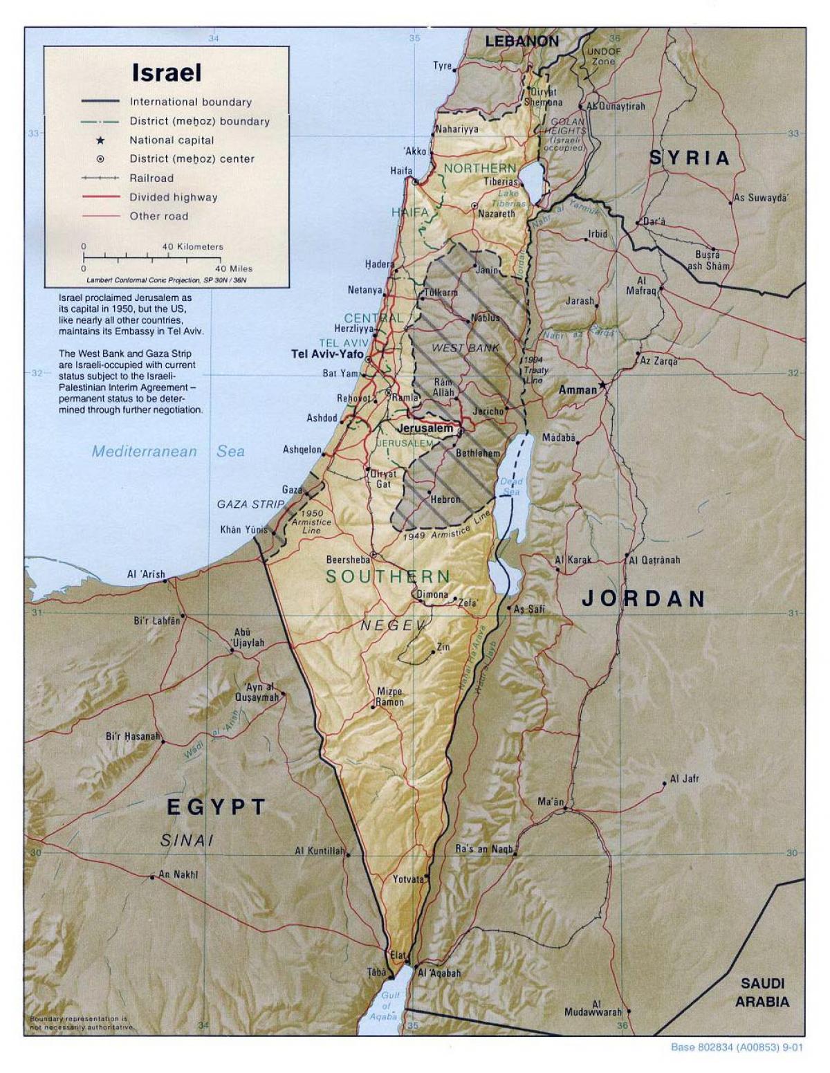
More than 90 percent of the Israeli people live in urban areas. The proclaimed capital and one of the largest cities is Jerusalem as its mentioned in the map of Israel with major cities. It sits high among the Judean hills in the center of the country along the border of the West Bank. Its walled “Old City” is divided into four quarters—Muslim, Jewish, Christian, and Armenian—symbolizing its significance to the region major religious and ethnic groups. Israel proclaimed Jerusalem its capital in 1949 and annexed East Jerusalem in 1967.
Jerusalem, Israel capital (population 788,100), has stood at the center of the Jewish people national and spiritual life since King David made it the capital of his kingdom some 3000 years ago. Today it is a flourishing, vibrant metropolis, the seat of the government and Israel major city. Tel Aviv-Yafo (population 404,300), which was founded in 1909 as the first Jewish city in modern times, is today the center of the country industrial, commercial, financial and cultural life as its shown in the map of Israel with major cities.
Haifa (population 268,200), a known coastal town since ancient times, is a major Mediterranean port and the industrial and commercial center of northern Israel. Be'er Sheva (population 195,400 as its mentioned in the map of Israel with major cities), named in the Bible as an encampment of the patriarchs, is today the largest urban center in the south. It provides administrative, economic, health, education and cultural services for the entire southern region.
The capital of Israel map shows the main city of Israel. This capital map of Israel will allow you to easily plan your travel in the capital of the country Israel in Asia. The capital of Israel map is downloadable in PDF, printable and free.
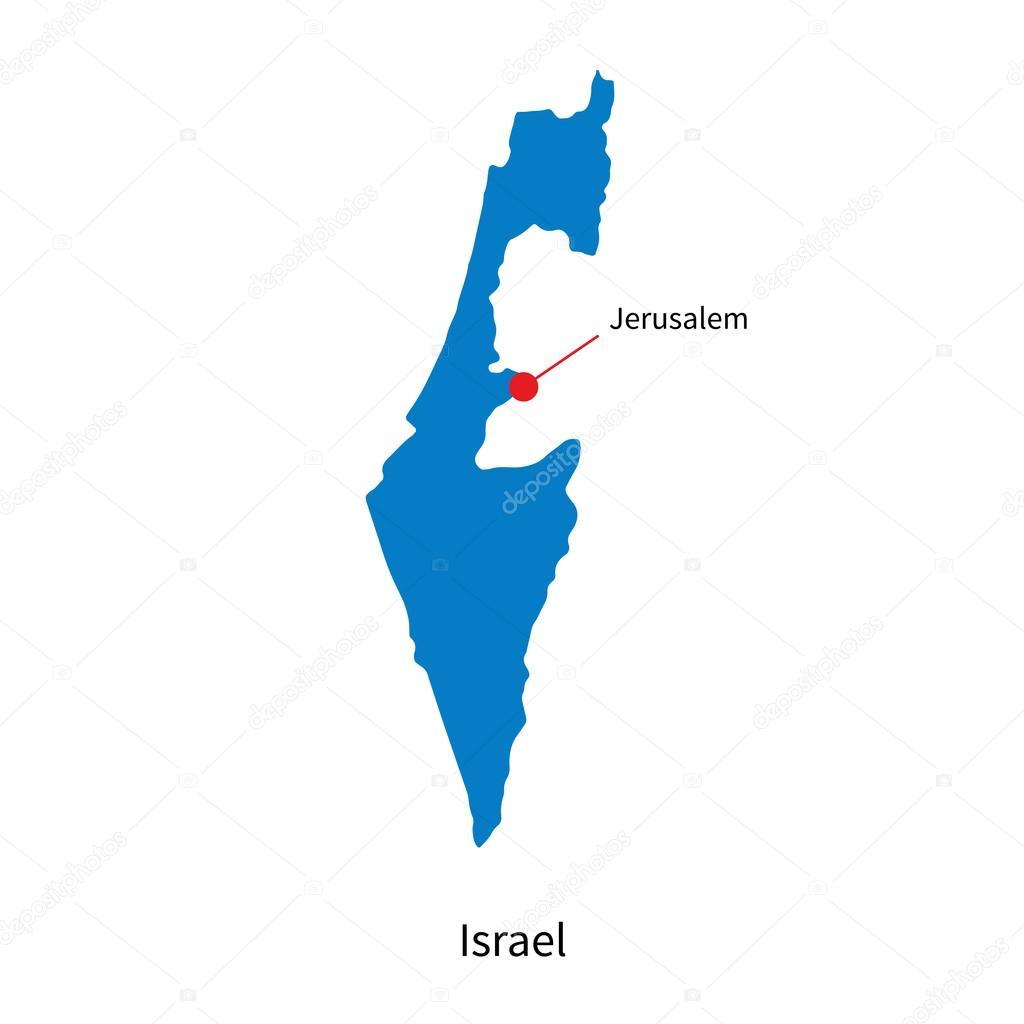
The Capital of Israel map is showing Jerusalem, seat of the Israeli government and largest city of Israel. The holy city of the Jews is sacred to Christians and Muslims as well. The city is located in the Judaean hills about 32 km (20 mi) from the Jordan River and about 30 km west of the northern tip of the Dead Sea.
The city of Jerusalem was settled in the 4th millennium BCE as you can see in the Capital of Israel map. According to traditional faith, David, the shepherd who killed Goliath, became the second king of the United Kingdom of Israel, he conquered the city from the Jebusites (a Canaanite tribe) and established it as the capital of the United Kingdom of Israel, his son, King Solomon, commissioned the building of the First Temple on the Temple Mount. Since biblical times the promised land is heavily contested by adherents of the three main religions which all originated in the region, and the city is since then the focus of warfare and pilgrimage likewise.
The city of Jerusalem was divided between the states of Israel and Jordan until the Israelis occupied the whole city in June 1967 and proclaimed it the capital of Israel although it is not accepted as such by the United Nations. The status of the city remained a central issue in the dispute between Israel and the Palestinian Arabs, who claim east Jerusalem as the capital of a future Palestinian state. As you can see in the Capital of Israel map, its area 49 square miles (126 square km). Population (2016 est.) 788,100.